blah blah blah
Galehead Mountain
Length: 10.4 miles out-and-backDifficulty (click for info): Very Hard
Elevation Gain: 2500 feet
Rating (click for info): 6/10
Elevation: 4024'
Prominence: 284'
Driving Directions:
Trailhead and parking area are on Gale River Loop Road in Bethlehem, NH (summit is in Franconia). Gale River Loop Road is on the south side of Rt. 3, 4.7 miles northeast of Rt. 93 at Exit 35 and 5.2 miles west of Rt. 302. Note: Gale River Loop Road is a loop which has two endpoints on Rt. 3. The mileages given are for the eastern entrance, which is closer to to the Gale River Trail parking area. This end of the road is 0.3 miles east of the bridge over the Gale River and across the street from Trudeau Road. Drive 0.6 miles down the road and bear left at an unsigned intersection, then continue 0.7 miles past this and turn right to stay on the road. The parking area is on the left, 0.3 miles after this.
About the Hike:
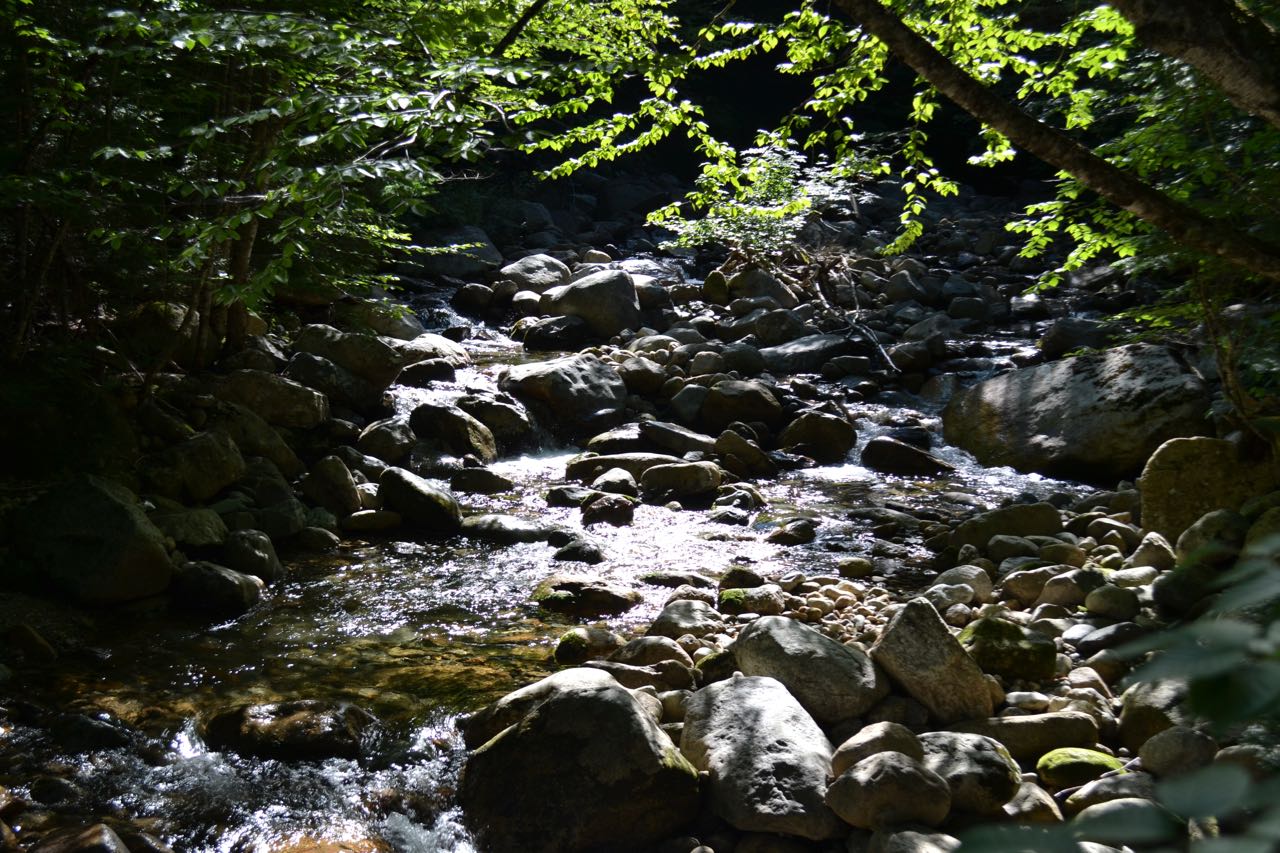
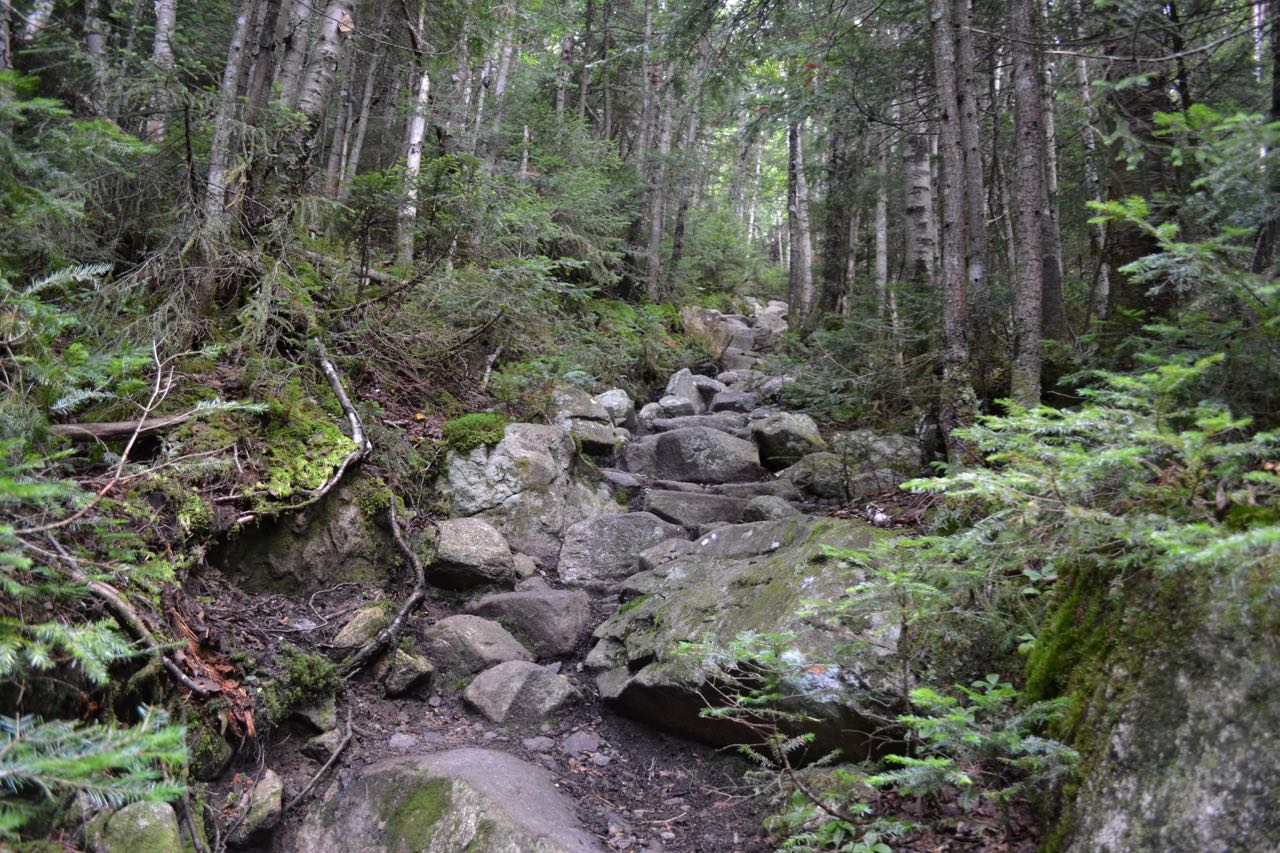
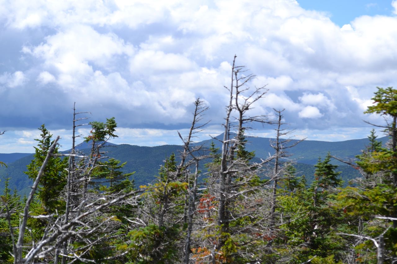
Galehead Mountain is a minor peak on the ridge connecting the Franconia and Twin Ranges. It is usually thought of as one of the least exciting 4000-footers. Its one and only viewpoint is an outlook 0.2 miles below the summit which provides an unusual view across the valley of Twin Brook to the side of South Twin Mountain. The hike to Galehead includes a pleasant and mostly easy walk in the area around the North Branch of the Gale River. Walk past the sign for Galehead Hut in the northeast corner of the parking area and begin hiking on Gale River Trail. The trail meanders for 0.2 miles, crosses a small brook, then begins a flat, easy mile-long section through the woods. The trail becomes rocky as it approaches the river. It passes several nice spots along the bank as it follows the river for 0.3 miles. It then turns sharply right where the original route of the trail continued ahead to cross the river. It switchbacks to an area higher above the river, then continues its gradual ascent, paralleling the river from a distance. In half a mile, the trail leads away from the river and descends slightly to cross Garfield Stream. This crossing is fairly easy, but if water is high, you should cross to the right of the trail, where there is a rope across the brook. The trail climbs on the other side, then eases and leads across the slope, heading back toward the river. It continues climbing very gradually for 0.6 miles, crossing several log bridges, then descends again to rejoin the former route of the trail. It then proceeds high up across the riverbank, passing through rocky and gravelly areas and crossing many small streams and runoffs. In 0.4 miles, it passes through an open area where you can walk down to the river. Past this, it goes back into the woods and continues its easy ascent, becoming slightly steeper for 0.4 miles until a right turn, where it climbs a stone staircase, turns back to the left, and climbs much more steeply over more stairs and rocky terrain for about half a mile to the end of the trail.
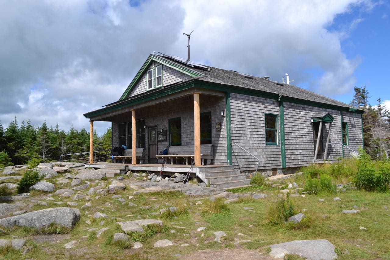
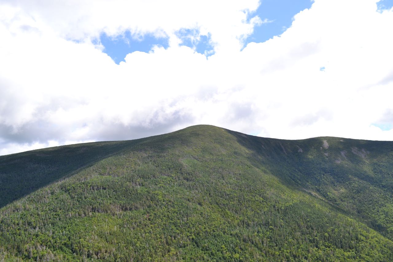
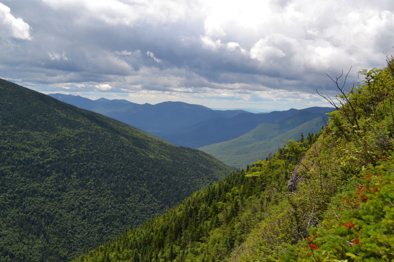
Turn left on Garfield Ridge Trail and follow it as it proceeds across the slope, going through minor ups-and-downs for 0.3 miles; it then reaches a limited view to the north from a cleared area. The trail then becomes rockier and begins to climb. It soon swings uphill and makes a final steep ascent, ending with an easy walk across rock through a mossy forest. Reach the end of this trail at a trail junction 0.3 miles from the view clearing. Turn right onto Frost Trail and continue a short distance to AMC's Galehead Hut. Here, you see the first view, from the clearing around the hut. Ahead is Galehead. Cross the hut clearing and continue on Frost Trail. The trail descends slightly into a blowdown patch where you can look up to the summit again, then continues to a junction with Twin Brook Trail. Bear right and stay on Frost Trail as it climbs steeply for 0.2 miles to a Galehead's main viewpoint on the left. This viewpoint overlooks the valley of Twin Brook. The view straight down to the bottom is especially impressive. To the left, you can see back down to Galehead Hut. North Twin Mountain is behind it. Across the valley, you can see up to massive South Twin Mountain. Its summit is on the left and to its right, a ridge leads over a knob and down to Southwest Twin. To the south, you can look down the valley to distant mountains. Farthest to the left is Mt. Osceola, partially hidden behind the side of Southwest Twin. To the right of it are the many peaks of Scar Ridge. Mt. Tecumseh is seen behind and between Osceola and Scar Ridge. To the right of this is the minor summit of Loon Mountain, with two of its ski trails visible. In front of Loon are the minor peaks at the south end of the Franconia Range, and closest and furthest to the right is Owl's Head, the peak at the south end of Owl's Head Mountain. Beyond the viewpoint, the trail becomes easier and leads 0.2 miles to the summit and ends at the summit cairn (actually a short distance past the summit). At this point, you can turn left and follow a herd path to an opening on the other side of the summit where there is a very limited view through the trees to Mts. Flume and Liberty, with Owl's Head Mountain below.
Printable directions page